*** Comes with everything in picture. This is brand new never used in the box. ***
***Shipping only in the United States***
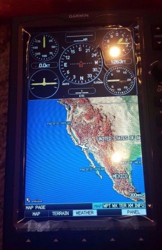
Meet our ultimate portable MFD: the GPSMAP 696, an all-in-one navigator designed exclusively for aviation. Featuring a large screen, detailed electronic charts and real-time weather, the 696 is your own personal avionics system.
See the Big Picture
The GPSMAP 696's bright 7-inch diagonal high-definition sunlight-readable display makes detailed mapping easy to see day or night - you can even view an entire approach plate on the large-format display. For easy operation, the bezel around the screen includes soft keys and a joystick control. And with a fast 5 Hz GPS update rate, the 696 renders graphics and presents flight data smoothly and continuously.
No Chart? No Problem.
With the addition of Garmin FliteCharts(R) and IFR map mode, the GPSMAP 696 has Class 1/Class 2 electronic flight bag (EFB) capability, reducing the use of paper charts in the cockpit. With FliteCharts, you can quickly find and view all U.S. NACO departure procedures (DP), standard terminal arrival routes (STARs), approach charts and airport diagrams. If the current approach is known, GPSMAP 696 automatically selects the correct chart based on the flight plan. When in IFR map mode, the 696 can display victor airways, jet routes, minimum enroute altitude and leg distance, much like found on paper enroute charts.
Add Weather and Radio
With the optional GXM 42 smart antenna, the GPSMAP 696 gives you access to high-resolution weather and audio entertainment right in the cockpit (XM subscription required). XM WX Satellite Weather includes next generation radar (NEXRAD), aviation routine weather reports (METARs), terminal aerodrome forecasts (TAFs), temporary flight restrictions (TFRs), lightning, winds aloft and more for the U.S. and Canada. In addition, the 696 can receive PIREPs, turbulence forecast and icing forecast information. The weather data can be laid directly over the unit's navigation and topographic map databases. With 170+ channels of digital music, news and programming through your aircraft headset or cabin audio system, you'll stay informed and entertained.
Enhance Situational Awareness
The GPSMAP 696 features a high-resolution terrain page showing hazards relative to your altitude and a vertical profile of terrain along your route of flight. It comes with a built-in Jeppesen database, and an Americas, Atlantic or Pacific terrain database. It also includes an obstacles database for the U.S. or Europe. Using this information, the 696 displays your flight route over contour terrain mapping. With information from the terrain and obstacles databases, the 696 monitors your current position in relation to surrounding terrain to provide alerts. You can even customize your own minimum clearance levels to receive terrain cautions. The 696 also comes with a realistic "view from space" satellite imagery basemap.
Like other portable Garmin devices, the 696 includes the following enhanced aviation databases:
- Garmin SafeTaxi(R)
Provides detailed taxiway diagrams and position information for over 850 U.S. airports. Preloaded on the unit, this information helps you navigate unfamiliar airports with confidence and shows your aircraft's exact position on the field. - AOPA Airport Directory
Offers detailed information for over 5,300 U.S. airports, along with the names and phone numbers of thousands of FBOs. Easily look up taxi services, plan an overnight, and choose fuel stops, plus find ground transportation, lodging, restaurants, local attractions and more. - Private Airports and Heliports
Provides data on private airports and heliports throughout U.S. and Europe, and materially expands your list of navigation and emergency "nearest" options.
Receive Altitude-Sensitive Alerts
When in the air, Garmin's new Smart Airspace feature makes it easier than ever to identify what airspace lies ahead. Smart Airspace automatically highlights airspace close to your current altitude and de-emphasizes airspace away from the current altitude, which gives you increased situational awareness.
Expand Your Portable
The GPSMAP 696 includes an SD card slot for extra memory and updates. Keep track of the databases on your GPSMAP 696 through www.fly.garmin.com, our online manager that helps you update, manage and purchase the latest aviation data for your Garmin device, all in one place.
 Garmin vfr aviation gps 100
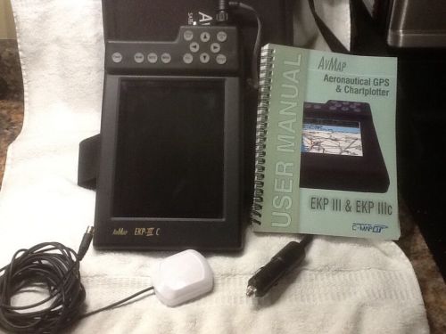 Avmap ekp111c
 Garmin gps 396 with pcas xrx traffic xm antenna 496 796 696 430
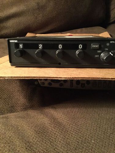 Transponder
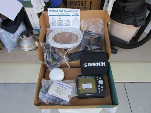 Marine-boat-sail-garmin gps map 168 sounder-ext antenna-transducer-new in box