Feature:

1. The 7‑inch color LCD display, 800 x 600 pixels, gives you a good visual experience while driving.
2. 50 parallel channel GPS receivers continuously track and use up to 50 satellites to calculate and update your location.
3. Compatible with C‑Map NT , you can download the relevant area map, external GPS antenna.
4. 30 route waypoints, up to 170 points per waypoint, and MOB and Track Navigation or Go Track mode.
5. 12,000 user waypoints with names and symbols. 3 system waypoints: MOB, start, cursor.
6. 10 adjacent waypoints. 8,000 automatic tracking logs; 10 saved tracks (up to 8000 track points per track) let you track paths in both directions.
7. Alarm XTE, anchor resistance, arrival, speed, voltage, approach waypoint and time, AIS alarm.
8. Tidal data, projected Mercator projection, position format latitude/longitude.
9. Onwa K‑Chart built into the basemap. Internal backup or external memory card for storing user data.


Specification:

Condition: Brand New
Item Type: GPS Chart Plotter
Color: Shown as Picture
Waterproof: IP67
Drawing Interval: 1s-9h or 0.01 nm-9.99nm
Plotting Range: 0.01nm-1,000nm
Navigation Data Input: $ – DBT, $ – DPT, $ – GGA, $ – GLL, $ – GSA, $ – GSV,
$ – HDG, $ – HDM, $ – HDT, $ – MTW, $ – RMB, $ – RMC,
$ –VTG,$ – ZDA,$ – VWR,$ – VWT,$ – MWD,$ – VPW
Output:
$ –AAM,$ – APB,$ – BOD,$ – BWC,$ – GGA,$ – GLL,
$ –RMB,$ – RMC,$ – VTG,$ – XTE,$ – ZDA,$ – DBT
$ –DPT,$ – WPL,$ – ZDL,$ – ZTG
Autopilot Output: $ –AAM, $ – APB, $ – BOD, $ – VTG, $ – DBT, $ – DPT
On/Off Perspective
Celestial Sunrise/Sunset, Moonrise/Monthly
Power Supply: 5 to 35VDC, Current Consumption 1.0A at 12V
Pixel: 800x600
Waterproof Display Unit: IPX5
Temperature Range Display Unit: -15°C-+ 55°C
Acquisition Time Cold Start: Average 60 Seconds
Warm Start: an Average of 27 Seconds
Hot Start: 45 Second on Average
Update Rate: 1 / Sec or 10 / Sec, Continuous
Accurate Position: 2.5 Meters (95%) Without S / A
Speed: 0.1 M / S (no S / A)
Time: ±100ns Synchronized with GPS Time
Dynamic Altitude: Up to 50,000m
Speed: 1640.42ft (500 M) / S
Acceleration: Up to 4g
Datum Wgs 84 and Others
Interface NMEA 0183 Input and Output, Rs232 Output

External GPS Antenna

AIS Interface
Data Input: NMEA 0183, RS232
Baud Rate: 38,400


Package List:

1 x GPS Chart Plotter 
1 x Screen Protector
1 x Connecting Line
1 x Instruction Manual
2 x
7 x Screw
1 x Bracket  
1 x Screen Rubber
4 x Double-sided Tape
1 x External GPS antenna (with 4M cable)


Note:


1. Our listing price includes the value of goods,packaging cost,and export taxes,not including international duties.
2. duties,taxes,and charges are not included in the item price or shipping fee.
3. The duties are buyers' responsibility.Please check with your country's customs office determine what these additional costs will be prior to your purchase.
4. All disputes arising from the duties will be submitted to ebay for solution.


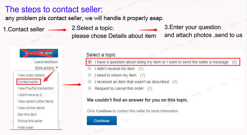
1. Any questions, pls. contact us via ebay message or email us.We will reply your message within 48 hours. If you do not receive our reply within 48 hours, pls. post a message again because sometimes our message system may block some emails.

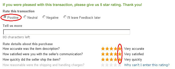
2. If you are satisfied with our service, pls. kindly leave us a positive feedback and give us the Detailed Seller Rating with all "5 " in very area
3. Our aim is to provide Level Customer Service, your recognition will encourage us greatly and serve you better. We strive to keep all our customers satisfy. 

https://image-us.chengykj.com/upload/third_resource/image/feedback.jpg


We will do our up most to exceed your expectations in customer service, communication and dispatching of your orders. 

https://image-us.chengykj.com/upload/third_resource/image/shipc73.jpg